
MISSISSIPPI RIVER
 Over
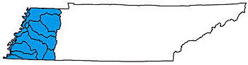
3,200 miles of rivers and streams are part of the Mississippi River Basin
in Tennessee. The U. S. Army Corps of Engineers-Memphis District manages
the basin to minimize flooding and maintain year-round navigation on major
rivers.
Over
3,200 miles of rivers and streams are part of the Mississippi River Basin
in Tennessee. The U. S. Army Corps of Engineers-Memphis District manages
the basin to minimize flooding and maintain year-round navigation on major
rivers.
The famous Spanish explorer Hernando de Soto first made the world aware of the Mississippi River in 1541. Over a century later, the French missionary Father Marquette explored the river extensively with his French-Canadian guide, Joliet. Over the years, the name "Mississippi" came to replace the original Choctaw word "Mesechabe," meaning "father of waters."
Historically, the Mississippi River defined Tennessee’s westernmost border. Water collected from all watersheds in the basin flows into the Mississippi River before it empties into the Gulf of Mexico, near New Orleans. The Mississippi River basin is almost uniformly flat, although some variety of elevations can be found in the southern part of the basin.
Although there are several metropolitan areas in the Mississippi River
drainage, most of the watersheds are sparsely populated and have flat
terrain with many farms and scattered wetlands. The major landmark in
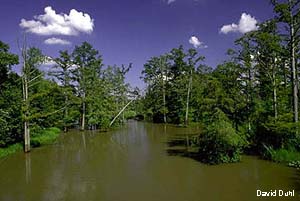
the basin is Reelfoot Lake, a popular state resort park, wildlife sanctuary
and designated state Natural Area. Reelfoot Lake was formed after a violent
earthquake in the winter of 1811-1812 when the Mississippi River is reported
to have reversed its course for a short time.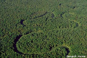
Many rivers in the basin, particularly in the Obion and Forked Deer River watersheds, have been channelized in an effort to reduce flooding and minimize the impact on agricultural practices. In recent years, this approach has been reconsidered, as the U.S. Army Corps of Engineers has provided evidence that channelization does not always result in reduced frequency of flooding. In the case of the Obion and Forked Deer Rivers, an agreement has been reached to return portions of the rivers to their original riverbeds. In contrast to the channelized rivers, the Hatchie River, running through the heart of the southwest part of the Mississippi River basin, is unchannelized and functions as an intact bottomland hardwood forest system, as much of West Tennessee once did. The Hatchie River is listed as a State Scenic River in its entirety. Similarly, parts of the Wolf River, in the extreme southwest portion of the basin, are unchannelized and have high quality bottomland hardwood forest communities occurring along scenic meanders. These sections are now part of the state Natural Areas System.
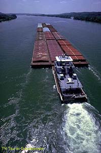
 Ultimately, the Mississippi River receives all
the water drained by the basin. Slow and methodical, the Mississippi River
supports barge traffic and helps provide Tennessee and the nation with
many of the goods we depend upon. Sometimes called Old Man River, the
Mississippi River played a prominent part in history and culture. Mark
Twain wrote about the Mississippi River and spent a fair amount of time
in Tennessee. Early settlers walked Tennessee’s Natchez Trace after
delivering their goods down the Mississippi. Today, the Mississippi River
is more than an historical footnote. Busy ports and commercial attractions
still make the river important.
Ultimately, the Mississippi River receives all
the water drained by the basin. Slow and methodical, the Mississippi River
supports barge traffic and helps provide Tennessee and the nation with
many of the goods we depend upon. Sometimes called Old Man River, the
Mississippi River played a prominent part in history and culture. Mark
Twain wrote about the Mississippi River and spent a fair amount of time
in Tennessee. Early settlers walked Tennessee’s Natchez Trace after
delivering their goods down the Mississippi. Today, the Mississippi River
is more than an historical footnote. Busy ports and commercial attractions
still make the river important.
To learn more, click on the watershed of your choice: