


BARREN RIVER
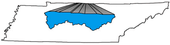
Located along the northern edge of the state, over 150 square miles of the Barren River Basin are within Tennessee’s borders.
Water collected by the Barren River watershed in Tennessee empties into the Barren River in Kentucky, then into the Ohio River before emptying into the Mississippi River. The hilly terrain of this watershed is primarily undeveloped.
BARREN RIVER WATERSHED
| The Barren River watershed includes parts of Clay, Macon and Sumner Counties and drains 413 square miles. Located along the Kentucky border in middle Tennessee, the area is primarily forested with some farming present. | 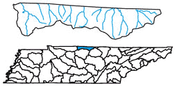 |
| NSQ = Natural/Scenic Quality RF = Recreational Fishing |
RB = Recreational Boating WQ = Water Quality |
STREAM DESCRIPTION
| Stream | NSQ | RB | RF | WQ |
| BEAN BRANCH CREEK | 3 | 1 | ||
| BIG TRAMMEL CREEK | 3 | 1 | ||
| CANEY FORK CREEK | 3 | 1 | ||
| DUTCH CREEK | 3 | |||
| GARRETT CREEK | 3 | 1 | ||
| LINE CREEK | 3 | 1 | ||
| LITTLE TRACE CREEK | 3 | 1 | ||
| LITTLE TRAMMEL CREEK | 3 | 4 | ||
| LONG CREEK | 3 | 1 | ||
| LONG FORK CREEK | 1 | 2 | 1 | |
| LONG HUNGRY CREEK | 1 | 2 | 1 | |
| MIDDLE FORK DRAKES CREEK | 3 | 1,2 | 3 | |
| PUNCHEON CREEK | 2 | 1 | ||
| SALT LICK CREEK | 1 | 2 | 2 | 1,3 |
| SULFUR FORK CREEK | 3 | |||
| TRACE CREEK | 3 | 1 | ||
| WEST FORK DRAKES CREEK | 2,3 | 1 | 1 | |
| WHITE OAK CREEK | 3 | 2 | 2 |
The Barren River watershed contains the headwaters of many tributaries that feed Kentucky’s Barren River.
