Printable Maps

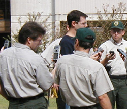
Brian Waldron, with the University of Memphis, has played a vital role in providing workshops for field staff. These workshops cover the protocol and utilization of using a GPS unit in data capture, as well as viewing and manipulating data.
|
On this page you will find a variety of maps available for printing or viewing onscreen. Please note that although the information on the maps is deemed to be accurate, the accuracy cannot be guaranteed. The information presented on the maps has been compiled from many sources and are considered reliable. The sources include, but not limited to, on the ground collection of points and lines with GPS, data capture using raster images, taxmap data, autocad files, and georeferenced survey plats.
You must have Adobe Acrobat Reader in order to view most of these maps. To download Adobe Acrobat Reader go to www.adobe.com/products/acrobat.
Printable Park Maps
Big Hill PondDavid Crockett
Frozen Head
Henry Horton
Long Hunter
Norris Dam
Panther Creek
Pickwick Landing
Red Clay
Roan Mountain


