


Governors Land and Water Forum 2007: Presentations
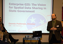 |
| Dennis Pederson, Office of Information Resources, GIS Services begins his presentation |
Cumberland Region Tomorrows Tool Box for Quality Growth
Bridget Jones, CRT Executive Director
TNCs Duck River Project
Leslie Colley, Tennessee Nature Conservancy
Update on Tennessee Heritage Conservation Trust Fund Act
Larry Marcum, TWRA
Session #1: GIS Activities in Government
Jason Duke, U.S. Fish and Wildlife Services
Jason Duke, US Fish and Wildlife Service, provided insight into the types of GIS data collected by the US Fish and Wildlife Service, one of the most widely used databases for GIS information.
Dennis Pederson, Office of Information Resources, GIS Services
Dennis Pederson, State of Tennessee’s Office of Information Resources, GIS Services, provided information on state efforts to create a GIS portal that would coordinate and house GIS data collected by state agencies. The goal is to establish standards for GIS data collection by state agencies and enable access to this information by other agencies, local governments and citizens.
Brian Waldron, University of Memphis Center for GIS Partnership
Brian Waldron, University of Memphis Center for GIS Partnerships, discussed work done by universities for local government, businesses and agencies on GIS storage of data and collection. Example was GIS work done for the Wolf River Conservancy.
Session #2: GIS Activities at Local Level
Daniel Carter, Tennessee Wildlife Federation
Daniel Carter, Tennessee Wildlife Federation, discussed potential for GIS to impact water resources and use as a tool to determine fragmentation of valuable agricultural land for subdivision and development.
John Chlarson, Municipal Technical Advisory Service
John Chlarson, Municipal Technical Advisory Service, discussed how GIS can effectively serve local government as a planning tool.
Session #3: GIS Activities in State Government
Bill Avant, Tennessee State Parks GIS
Jeanette Jones, TWRA
Ward Tarkinton, Department of Agriculture Division of Forestry
Ward Tarkington, Division of Forestry, Jeannette Jones, Tennessee Wildlife Resource Agency,
and Bill Avant, GIS State Parks discussed how GIS can help identify critical resources for future acquisition plans and improve management decisions by providing important information through mapping.
